Featured product
Custom Willamette Valley Wine Pendleton Blanket Season 3
- Regular price
- $319.00
- Sale price
- $319.00
- Unit price
- per
This custom wool blanket is designed depict the major landscape features the Willamette Valley; geographic elements, vineyard element, vineyard colors and Pacific Northwest forests are all represented with classic Pendleton shapes recognizable around the world. It is the latest release in a series of unique palettes intended to evoke the colors of winter in the Willamette Valley when cold, clear skies showcase brilliant sunrises that bleed into vineyard landscapes at dawn.
n 2018, the Willamette Valley Wineries Association designed its first custom Pendleton blanket (season 1) that honors the land, the wine, and the people of Willamette Valley wine country.
In 2021, we released the second season of the blanket updated with the colors that saturate our landscapes during the days just before harvest, when vines are laden with nearly ripe fruit and sunrises bleed into vineyards at dawn's light.
Our newest blanket is season 3 with cool, vibrant blues.
BLANKET SIZE: The blanket is 64″ x 80″, perfect as a picnic blanket, cozy campfire or fireplace throw or footer on a queen-sized bed.
The price includes free ground shipping. Expedited shipping is not available.


Featured product
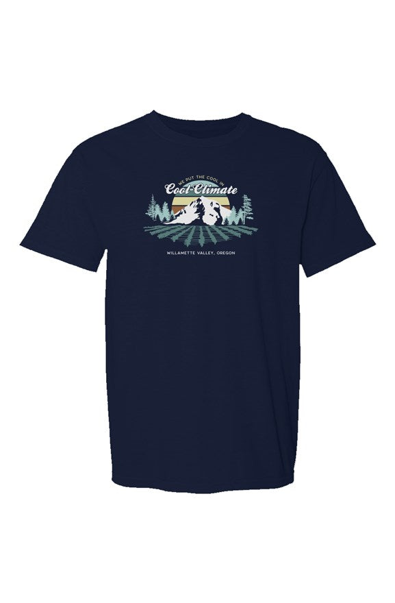
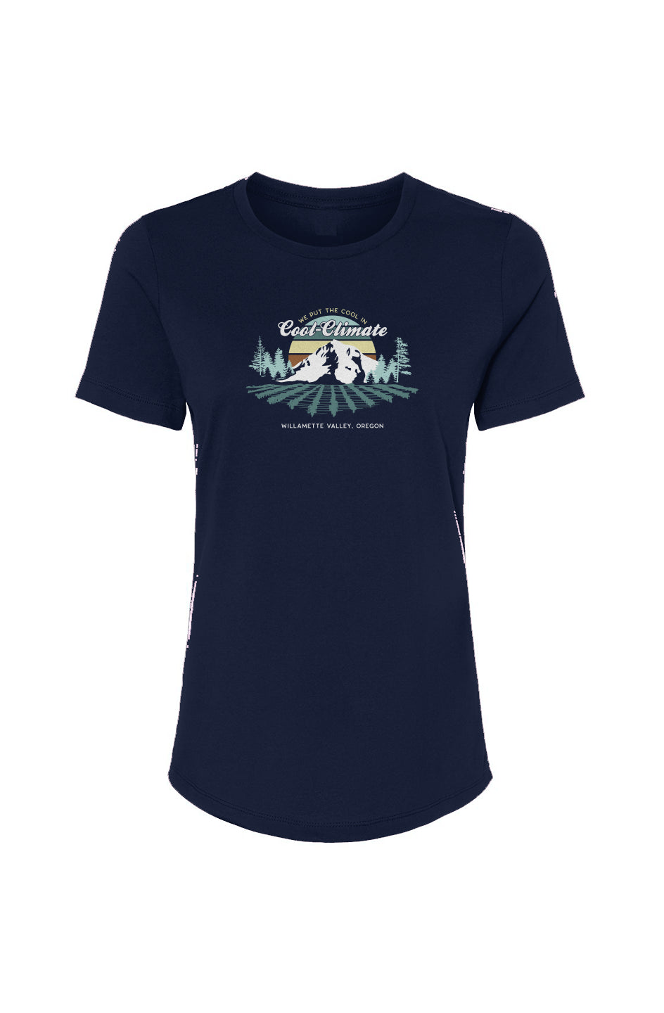
CREW NECK T-SHIRT | We put the cool in cool climate
- Regular price
- $30.00
- Sale price
- $30.00
- Unit price
- per
PLEASE NOTE: Because this item is printed on-demand, we are unable to offer refunds or exchanges.
This mid-weight, universal-style t-shirt is super-soft and made in the USA.
Benefits
- Highest Labor Standards
- Supports US Manufacturing
- Exceptional Quality
- 4.3 oz. 100% combed and ringspun cotton jersey
- side seamed
- Unisex Crew T-shirt
For environmental and human friendly reasons, this product is only made when you order it. Typically, this product will be made in about a week, we will send you tracking information as soon as it's in the mail.


Featured product
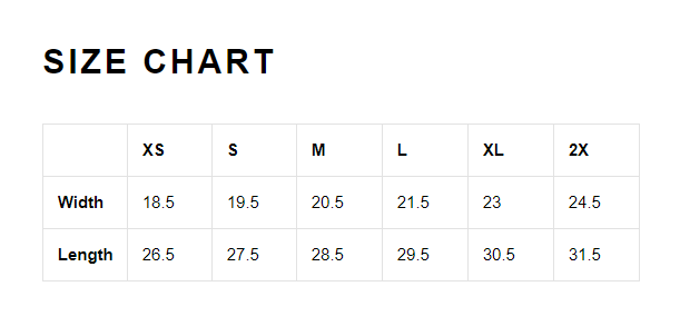
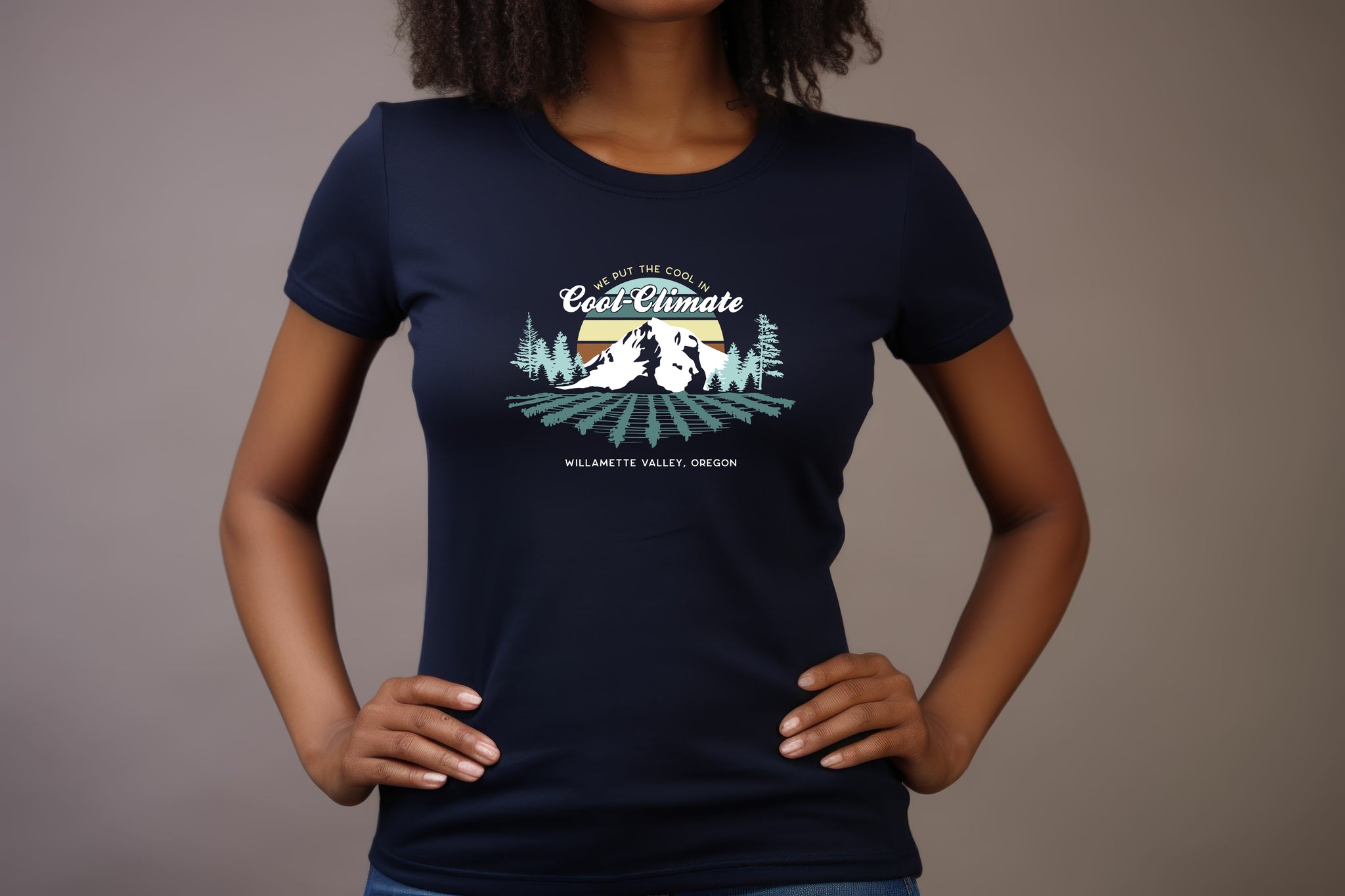
Women’s Relaxed Jersey Tee
- Regular price
- $30.00
- Sale price
- $30.00
- Unit price
- per
PLEASE NOTE: Because this item is printed on-demand, we are unable to offer refunds or exchanges.
Designed with a new modern, relaxed fit for effortless style. It features short sleeves and light material which makes it a go-to for relaxing in hot weather.
Features
- 4.2 oz., 100% combed and ringspun cotton, 32 singles
- Relaxed fit, side seams
For environmental and human friendly reasons, this product is only made when you order it. Typically, this product will be made in about a week, we will send you tracking information as soon as it's in the mail.


Featured product
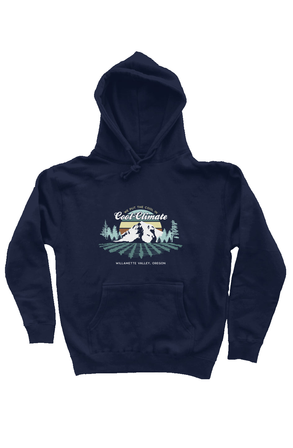
Heavyweight Pullover Hoodie
- Regular price
- $59.00
- Sale price
- $59.00
- Unit price
- per
PLEASE NOTE: Because this item is printed on-demand, we are unable to offer refunds or exchanges.
A classic style heavyweight pullover hoodie.
Benefits
- Handcrafted with premium ring spun cotton
- Created with a 3-end fleece for comfort
- Premium heavyweight garment has a generous fit and is completed with a fleece lined hood
- Heavy gauge round drawcord
- Nickel eyelets
- 1x1 ribbing at cuffs and waistband
- Unisex
Features
- 10 oz (330 gm) cotton/polyester blend 3-end fleece
- ring spun cotton
- 70% Cotton/30% Polyester with 100% cotton 32 singles face yarn for supreme printability and softness
- fleece lined hood
- split stitch double needle sewing on all seams
- twill neck tape
- nickel eyelets
- 1x1 ribbing at cuffs and waistband
For environmental and human friendly reasons, this product is only made when you order it. Typically, this product will be made in about a week, we will send you tracking information as soon as it's in the mail.